We have been using drones to survey our sites since 2016 - back when I worked at the Great Fen. They basically give us the chance to survey huge areas of habitat in a short period of time - and collect nice video and photos for publicity while we are there.
I was recently asked to visit Houghton Regis Chalk Pit by the Wider Countryside team - a site that we managed as a Nature Reserve until sometime around 2015/2016. It's a spectacular site, with huge chalk cliffs from the excavations, and a maze of paths.
Using the drone, I was able to survey the site in a few hours. Flight range is limited, so that meant eight individual flights from different points on the site - and a lot of scrambling around to get there.
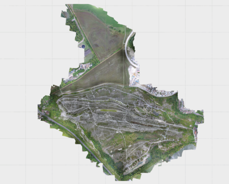
The drone flies a predetermined path at 300ft, and takes hundreds of overlapping images with accurate GPS. For this large site, that meant 600 high-resolution images were taken.
Back at the office - these images are uploaded to the cloud and processed automatically. We learnt early on that the processing power needed will strain the average computer.
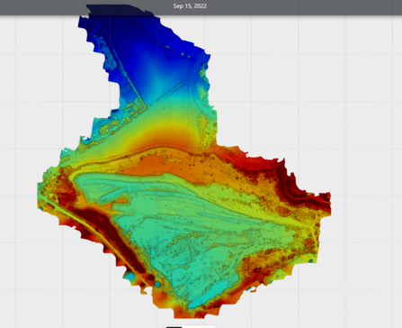
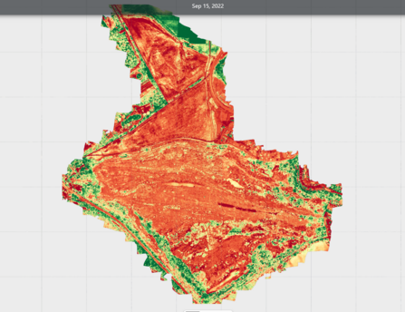
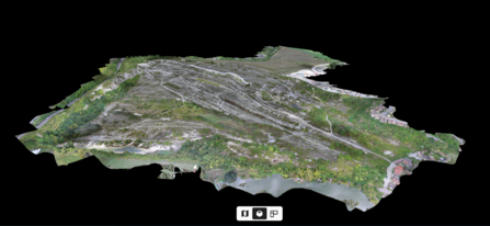
The outputs are shown here - we get a very accurate aerial image, elevation model, 'plant health' layer and a 3D model. These are then used to help us accurately map different habitats at a site.
The beauty of being able to do our own drone work is that we can go out and repeat this whenever needed - and we know the sites well. The maps we produce are now used for our Conservation work - and the photos/videos appear on the website and in various publications.
Aside from all the clever stuff - it is a great excuse to visit some of our less-visited nature reserves and see parts of the site that I have never been to.
Use of drones is definitely here to stay, and we now have 3 pilots at the Trust. Training and kit is now relatively inexpensive - and many conservation organisations are getting involved.