Shepreth L Moor
Know before you go
Dogs
When to visit
Opening times
Open at all timesBest time to visit
spring and summerAbout the reserve
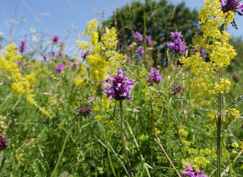
This L-shaped area of grassland is a mosaic of wet hollows and drier chalky areas created when the site was dug over for coprolites. A combination of scrub areas, a chalk stream and pollarded willows along the boundaries, has lead to the rich diversity of flowers and insects that makes the site so special.
The Moor was given to the cottagers of Shepreth in 1823 to graze their livestock. The old footpaths and many ant hills indicate the area has been unploughed for centuries, providing enjoyment for generations of local people. Where rabbits have nibbled the turf short there are mats of wild thyme and delicate blue harebell. You'll see purple swathes of bugle, at their peak in May, on either side of the railway line, and plants such as devil's-bit scabious, fen bedstraw, sedges and rushes grow in the wetter areas.
Additional information
- Scroll down to see the reserve boundary. Please note the boundary map is for indication purposes only and does not show the Wildlife Trusts definitive land boundary.
FOR ANY MEDIA ENQUIRIES PLEASE CONTACT OUR COMMUNICATIONS TEAM: communicationsteam@wildlifebcn.org or 01954 713500 and ask for comms team.

