Old Sulehay Forest - Robert Enderby
Location
Know before you go
Dogs
When to visit
Opening times
Open at all timesBest time to visit
All year roundAbout the reserve
Old Sulehay Forest is a fragment of the ancient Rockingham Forest, a royal hunting forest that extended from Wansford to Kettering. Other areas of the reserve are associated with quarrying. Stonepit Close was exploited for its limestone, while areas of Ring Haw were quarried for limestone, ironstone and silica clay; remains of the quarry railway track beds and sidings can still be seen. The area known as the Calcining Banks was used to refine extracted iron ore known as calcined ore.
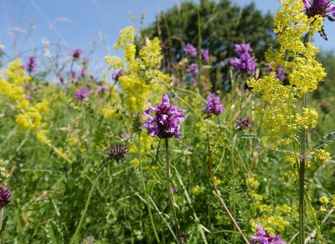
In summer, glow-worms glimmer in the longer grass. Many wildflowers found here are rare in Northamptonshire, including ploughman’s-spikenard, wild thyme, viper’s bugloss, common cudweed and yellow-wort. These attract a wide range of butterflies, such as common blue, brown argus and dingy skipper. On warm spring days look for the energetic grizzled skipper in Stonepit Close, on the disused railway or the Calcining Banks.
Areas of scrub support birds such as whitethroat and bullfinch. Great and lesser spotted woodpeckers live in the woodland along with nuthatch and treecreeper. Invertebrates thrive on the sun-warmed paths and rides.
To maintain the varied habitat structure most of the grassland is grazed with rare-breed sheep and cattle to maintain low soil fertility. Using wildflower seeds collected from other limestone grassland sites in the area, Sammock’s Hill was restored from arable land. It now boasts a variety of native flowers, including cowslips, bird’s-foot trefoil, knapweed broomrape and pyramidal orchids.
Old Sulehay Forest is ancient abandoned coppice of ash, hazel, oak and field maple, with a diverse ground flora. We are reintroducing coppicing and we fell trees to maintain the wide, sunny rides favoured by wildlife – and people.
Additional information
- Old Sulehay is one of the reserves in the John Clare Living Landscape.
- Scroll down to see the reserve boundary. Please note the boundary map is for indication purposes only and does not show the Wildlife Trusts definitive land boundary.
FOR ANY MEDIA ENQUIRIES PLEASE CONTACT OUR COMMUNICATIONS TEAM: communicationsteam@wildlifebcn.org or 01954 713500 and ask for the comms team.
Species
- European badger
- Red fox
- Bullfinch
- Buzzard
- Fieldfare
- Great spotted woodpecker
- Green woodpecker
- Lesser whitethroat
- Nuthatch
- Red kite
- Redwing
- Snipe
- Treecreeper
- Turtle dove
- Woodcock
- Grass snake
- Green tiger beetle
- Bluebell
- Bramble
- Common spotted-orchid
- Cowslip
- Dogwood
- Wild garlic
- Viper's-bugloss
- Wild thyme
- wood anemone
- Yellow-wort

