Thank you for volunteering for the Ancient Woodland Inventory woodland survey taking place between March and 31st August 2024
This webpage contains information on how to complete the surveys. Please read the Ancient Woodland Survey Guidance document first. This explains how to find the woods which need surveying, what features we are asking you to look for and how to identify them.
Survey results should be submitted using either the Word survey form or an online form.
Ancient Woodland Survey Guidance
How to carry out a survey
High quality images of all maps are available to view and download here
-
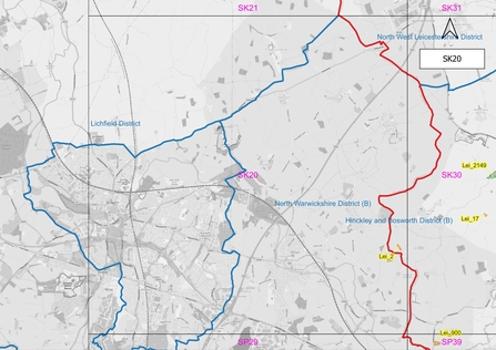
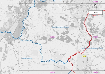
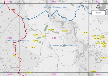
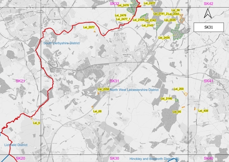
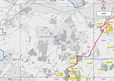
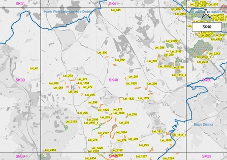
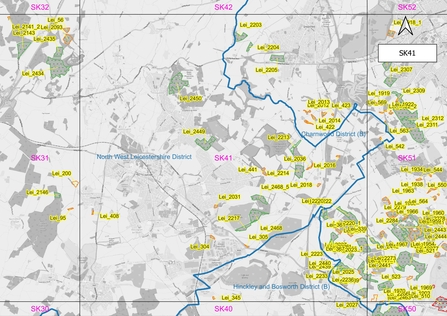
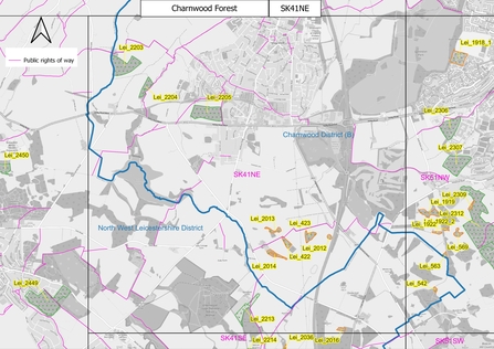
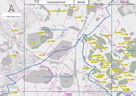
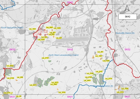
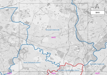
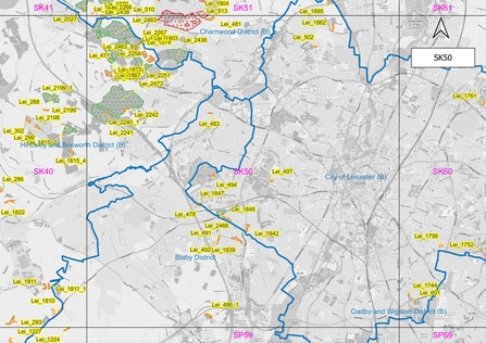
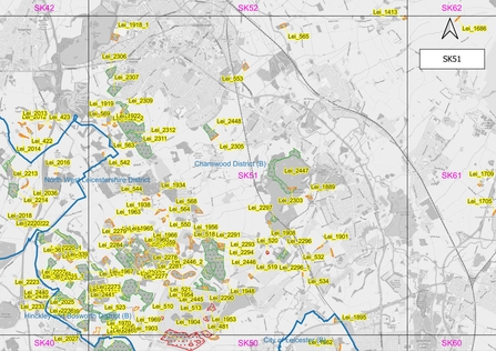
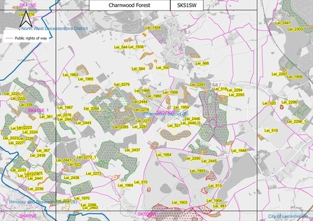
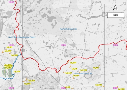
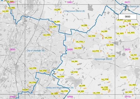
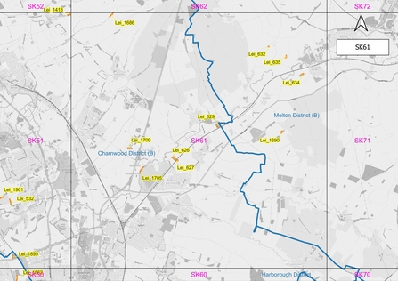
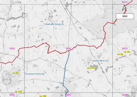
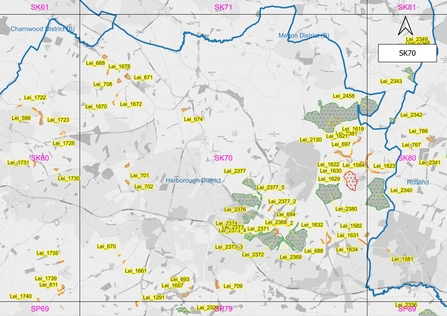
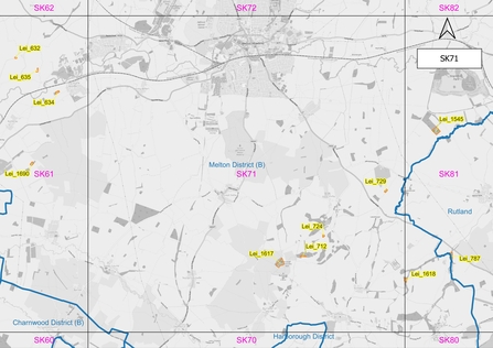
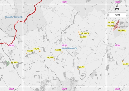
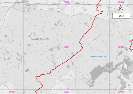
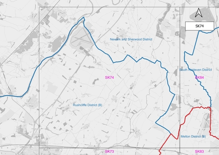
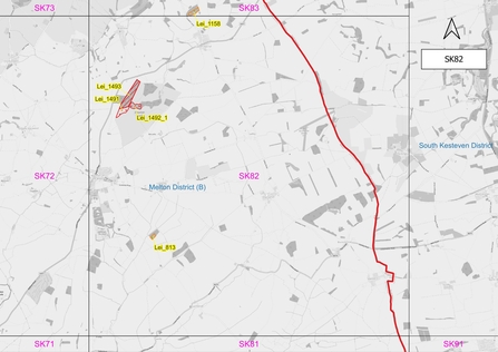
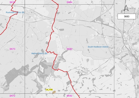
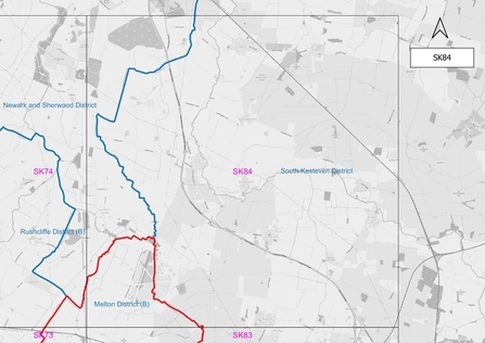
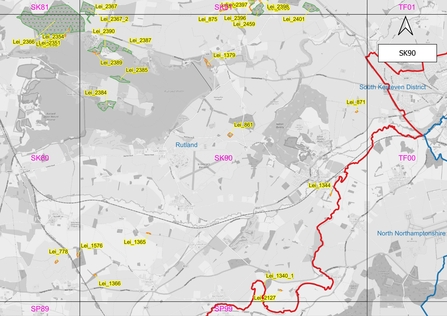
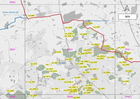
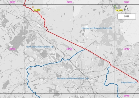
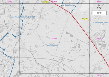
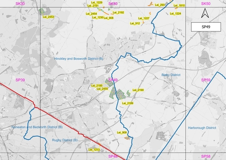
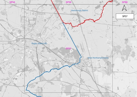
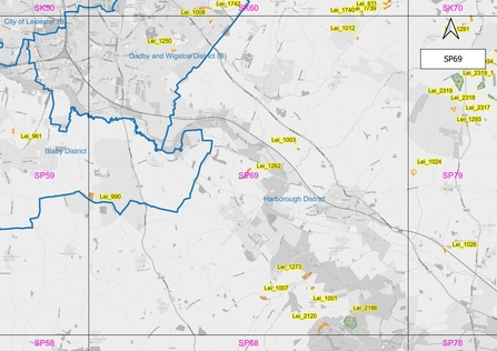
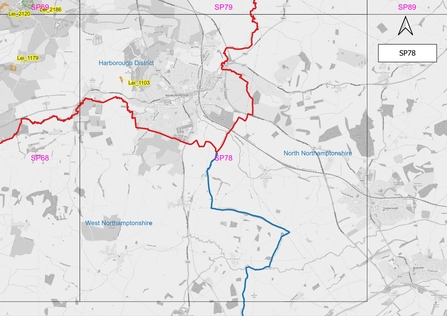
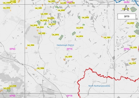
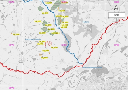
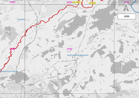
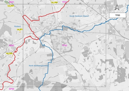
Identify the part of the county you are interested in on the Leicestershire and Rutland county map (also found here in the county map folder). Note the corresponding 10 km square (SK80 for instance).
-
Locate the map for the selected 10km square by scrolling through the list of maps below the key and check them for the presence of ancient woodland. Some squares contain no ancient woodland - large parts of Leicestershire and Rutland were cleared well before 1600.
-
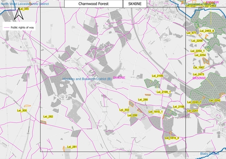
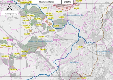
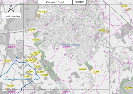
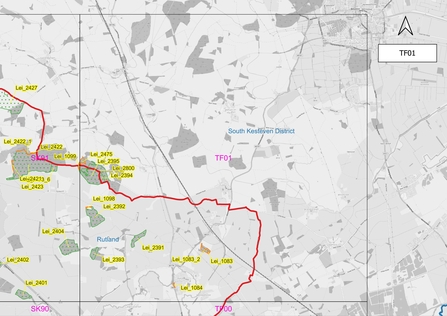
Open the higher quality images found in the folder Leicestershire & Rutland 10km grid square maps. For the Charnwood Forest area there are more detailed maps to help separate woodlands.
-
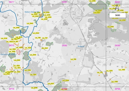
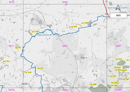
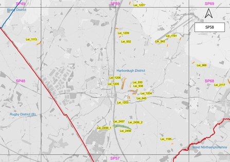
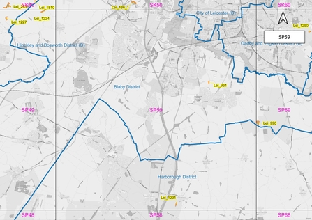
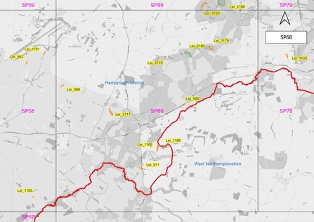
On the map each wood is labelled with a Unique Identification Number (UID) - for example Lei_2431. Some larger woods are divided into parts each with a separate UID. Note: where there are many sites close together some of the labels may overlap - identify a nearby site and open the more detailed map (see below) which will allow all UIDs to be read.
-
Select a wood to survey and view the woodland map labelled with the corresponding UID in the Leicester and Rutland woodland maps folder. Designated public rights of way are indicated on the maps. Only survey sites if they are open to the public or are crossed by a public right of way or are visible from a road or other public right of way or you have permission from the landowner/manager to visit.
-
Woods are coloured to indicate their status (see below):
i. Potential new ancient woodland (orange)
ii. Currently designated Ancient Woodland (green)
iii. Potential Ancient Wood Pasture (red)


Map data from OpenStreetMap
Imagery ©2024 Airbus,Bluesky,CNES / Airbus,Getmapping plc, Infoterra Ltd & Bluesky, Landsat / Copernicus,Maxar Technologies, Map data 2024 ©2024 Google
OS data used under Natural England Contractors Licence ref: NE-2023-8-18-12-8-36
Higher quality maps can be found here.
Find the woodland on the "Woodlands for Survey" spreadsheet
Leicestershire and Rutland Woodlands for Survey spreadsheet
-
Use the UID to find the woodland on the spreadsheet. This will give you its name (if known), location information, including parish, Ordnance Survey Grid Reference and What3Words and a basic description of woodland type.
-
Make a note of the site’s UID, grid reference and parish – you will need these later to complete the record form.
-
Use any one of the following to find the wood on a map:
- To confirm the location on a paper map using the OS grid reference: A beginners guide to finding grid references | OS GetOutside (ordnancesurvey.co.uk)
- To confirm the location on a phone or laptop enter the grid reference or What3Words into Grid Reference Finder: Grid Reference Finder
-
To confirm the location on your phone with What3Words download the App: Download the free what3words app | what3words
Completing the Survey
Before visiting a wood please read through the survey form to familiarise yourself with features you are being asked to look out for.
Completed surveys should be submitted using the online form or the downloadable survey form.
Leicestershire and Rutland Woodland Survey Online Form
Leicestershire and Rutland Woodland Downloadable Survey Form
 Other volunteering opportunities in Leicestershire and Rutland can be found here