Pegsdon Hills - Robert Enderby
Pegsdon Hills and Hoo Bit
Know before you go
Dogs
When to visit
Opening times
Open at all timesBest time to visit
April to June, July to September, October to MarchAbout the reserve
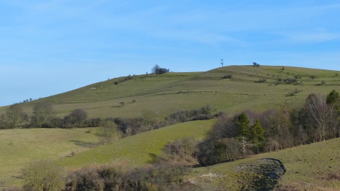
One of the jewels of the Chilterns Area of Outstanding Natural Beauty, Pegsdon Hills’ steep chalk hills offer some of the best views in the county. In spring, moschatel, or town-hallclock, named after the arrangement of its flowers, can be found in the woodland, while dingy and grizzled skipper butterflies flutter around in the grassland.
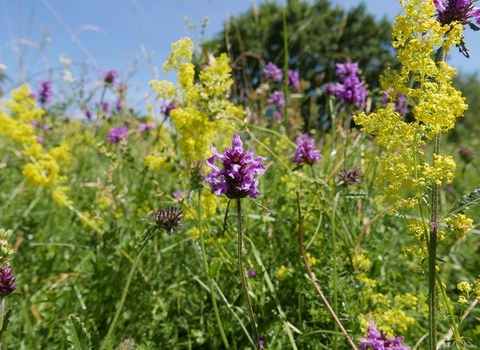
With summer arrives the smell of fresh herbs like wild thyme, marjoram and wild basil. The melodious song of the skylark is heard around the reserve. After dark the eerie green luminescence of glow-worms emanates from the grassland and bats fly overhead. Hoo Bit, once a larch plantation, is now a flower-rich grazed meadow, surrounded by woodland. White helleborine flowers in large numbers beneath the dense shade of beech trees. In autumn, honeysuckle, black bryony and old-man’s-beard drape over trees and shrubs offering seeds and berries to hungry birds and small mammals.
In winter, fallow deer skirt along the woodland edge, while flocks of birds feed on seeds in hedgerow and field. We coppice in the wood and fell trees to allow light to reach the woodland floor.
The deep earthwork on the Bedfordshire/Hertfordshire county boundary was once a barrier to free passage, situated as it is near to the ancient route of the Icknield Way. Large, multi-stemmed beech trees now mark its presence. Strip lynchets, or cultivation terraces, are evidence of an ancient settlement and there is a series of small quarries indicating former small-scale mineral extraction.
The grassland is grazed and we remove scrub to prevent succession.
Additional information
- We have work parties for the North Chilterns Chalk nature reserves. See the Bedfordshire work party page for more information.
- Scroll down to see the reserve boundary. Please note the boundary map is for indication purposes only and does not show the Wildlife Trusts definitive land boundary.
FOR ANY MEDIA ENQUIRIES PLEASE CONTACT OUR COMMUNICATIONS TEAM: communicationsteam@wildlifebcn.org or 01954 713500 and ask for comms team.

