Josh Hellon
Wildlife Trust BCN
The Hayfield, Blow's Downs by Esther Clarke

Blow's Downs - John Constable
Blow's Downs
Location
Know before you go
Dogs
When to visit
Opening times
Open at all timesBest time to visit
Spring and SummerAbout the reserve
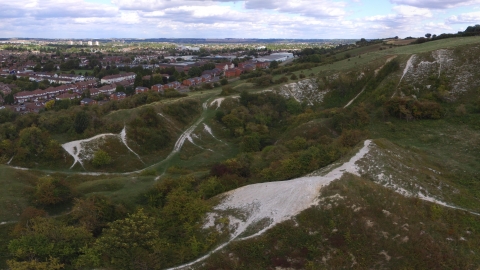
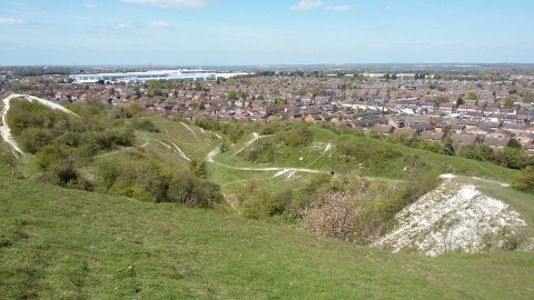
The steep chalk hills rising from the edges of Luton and Dunstable have allowed this site to retain grassland full of colour, with areas of scrub providing shelter for birds and insects. The reserve includes a small disused quarry and banks associated with Medieval cultivation terraces. Similar sites have declined nationally and because this reserve is a fine example of this habitat, it is a designated Site of Special Scientific Interest.
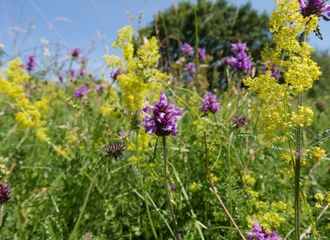
The views from the top are well worth the climb. The slopes themselves are covered with flower-rich grassland, home to possibly the largest population of great pignut in the county. In spring, orchids dot the hillsides, followed by the late summer hues of wildflowers such as scabious and knapweeds. The steepest banks where the soils are very thin and nutrient-poor are where less competitive, lower-growing herbs can flourish. These include horseshoe vetch, common rock-rose and kidney vetch, the foodplants of the specialist chalk butterflies chalkhill blue, brown argus and small blue.
In spring and autumn, migrant birds stop off at Blow’s Downs to feed before heading off once again on their way to their nesting or wintering grounds. Wheatear, stonechat, whinchat and ring ouzel are among the most notable seasonal visitors.
We prevent woodland succession on the grassland by grazing with cattle and ponies, and by removing scrub. To compensate for wildlife habitat lost to the Guided Busway, three acres of land were added to Blow’s Downs nature reserve. The Paddocks, the Hayfield and Chaul End field are all now managed for the benefit of wildlife.
Additional information
- We have regular work parties in our North Chilterns Chalk reserves. See the work party page for more information.
- Scroll down to see the reserve boundary. Please note the boundary map is for indication purposes only and does not show the Wildlife Trusts definitive land boundary.
FOR ANY MEDIA ENQUIRIES PLEASE CONTACT OUR COMMUNICATIONS TEAM: communicationsteam@wildlifebcn.org or 01954 713500 and ask for comms team.

